


Hiking trails in La Graciosa
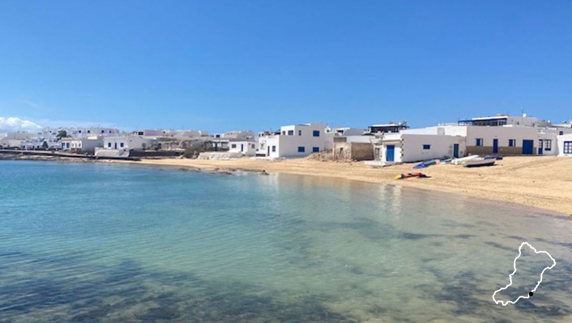
La Graciosa is not a big island, allowing you to get to know it by walking the trails that cross and run and lead us to those virgin, solitary beaches, which are paradise in every sense of the word.
Being a protected Natural Parka series of rules must be followed to help preserve this natural wonder so that the landscape, plant life and marine life are not affected by the presence of tourists. Therefore, we should never veer from the paths of the routes in order to avoid erosion of any particular area because vegetation might not grow again, and at the same token do not disturb the marine wildlife or tear out wild plants, as many species are endemic, ie – this is there one and only home.
Depending on the hours available to spend on the island, recommended routes vary because if you’re restricted by boat timetables back to Lanzarote you will have to be selective over which route to choose in order to make the most of the beaches, sun and the island.
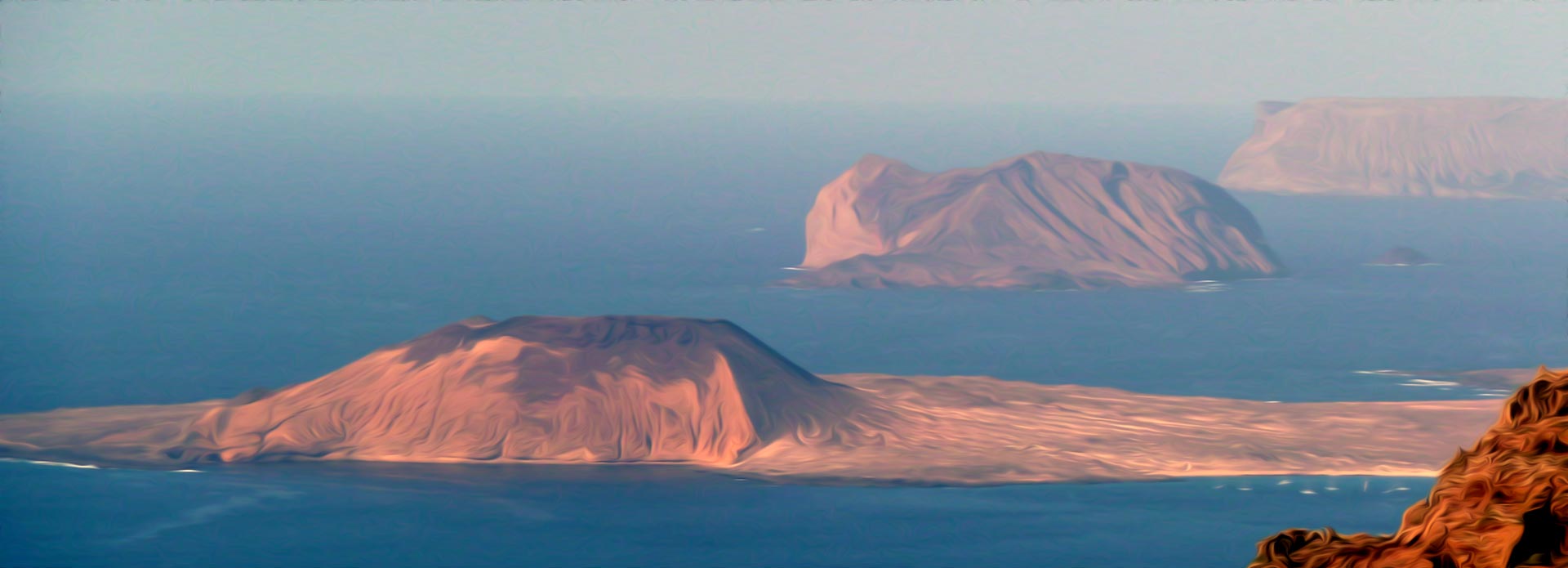
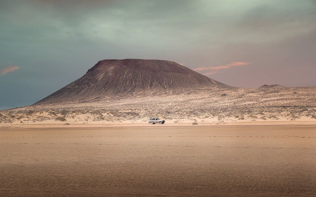
La Graciosa is pure volcanic landscape where there are no trees or shade to shelter from the sun on the paths. There is also no possibility of replenishing food or water on the routes and beaches, so a good hat or cap, sunglasses, enough food and water, and sunscreen should not be missing in any backpack on the routes, as well as proper footwear of course.
There are 4 main hiking trails found on the island that leads us to the main points of interest on the islands.
From the beach of La Cocina to Montaña Amarilla
From Corral to Punta del Pobre
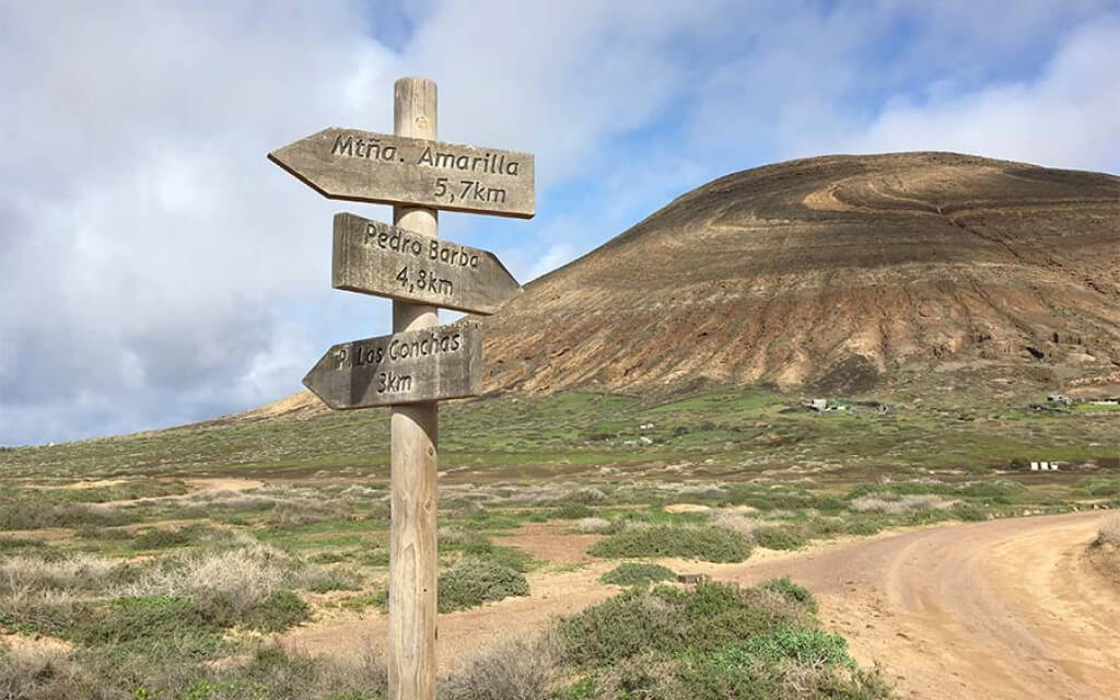
From Las Conchas, Majapalomas and Pedro Barba
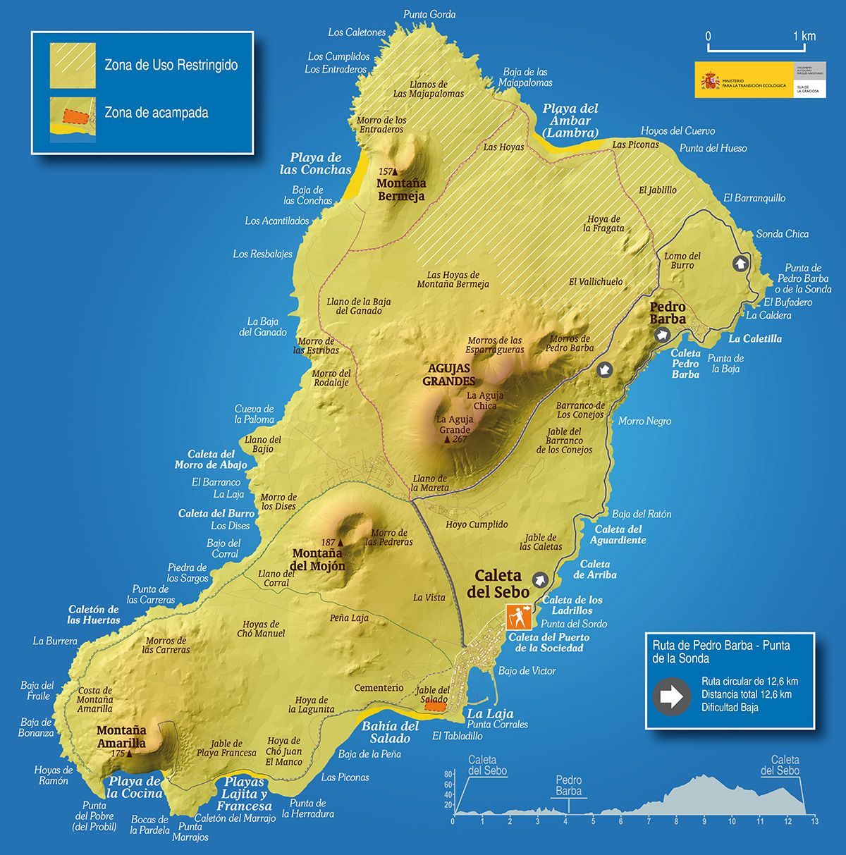
From Pedro Barba to Punta de la Sonda
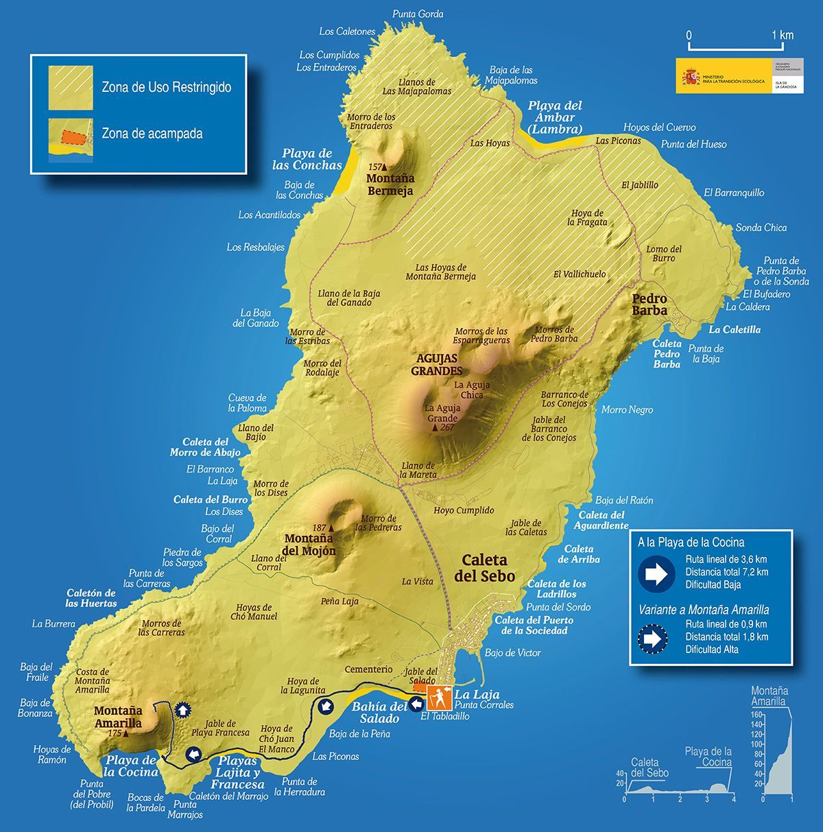
This route by foot in La Graciosa that goes south; towards the beaches of El Salado, La Francesa and La Cocina, taking in Montana Amarilla as the final point of the journey is usually chosen by the people who come to spend the day on the island.
You only need to follow the coastline, there is nothing to lose. First explore the Bahia del Salado, and then continue to the clear blue waters of Playa de La Francesa; and if you want to go further follow the path that will take you to Playa de La Cocina and Montana Amarilla.
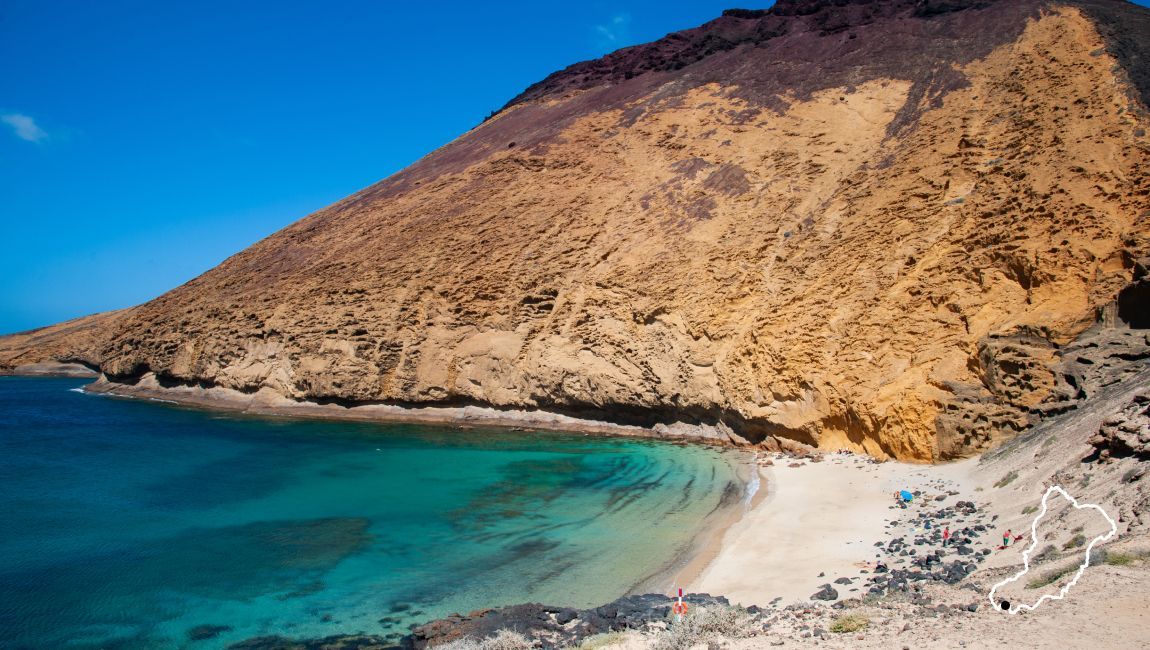
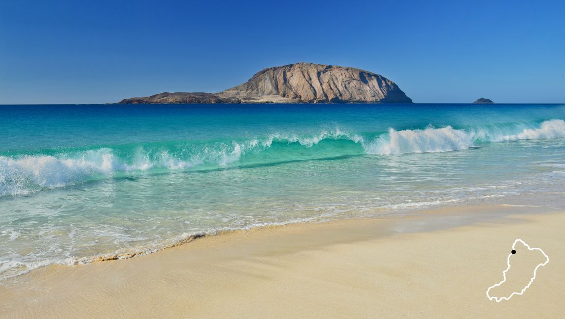
There are two emblematic beaches on this island; one for the transparency and tranquility of its turquoise blue waters, and the other due to where it is and the contrast of colours between its waters and the mountains.
The route without climbing to the summit of Montana Amarilla is 6kn and take s around and hour and a half on foot without a break to bathe on one of the beaches on the way.
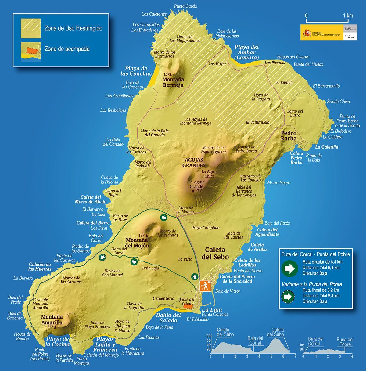
This trekking route in La Graciosa has two options. The first one is circular and runs along the lower part of El Bajo del Corral, the Llano de la Mareta and comes back via the Llano del Corral and the foothills of the Mojon.
You can extend the route with the other option to get to Punta del Pobre, ie the the northeastern coast of the island to the base of Montana Amarilla, where there is a wonderful viewpoint of Playa de La Cocina.
Choosing this second option adds another 6km to the hiking route, which is not difficult because the route is flat and runs parallel to the coast, making it a very enjoyable walk to the Punta del Pobre.
The first part of the route is common for both. It leaves from Caleta de Sebo and heads towards La Mareta, first with a stretch of light ascent until the crossroads flanked by la Montana del Mojon and las Agujas. At this point you take the path to the left in the direction of Punta del Pobre, after about 500m the road forks again and you take the one on the left surrounded by Montana del Mojon, go down via the Baja del Corral where we can see the entire coast and circulate parallel to it. Once here there is another path, which if not taken and followed will lead you Punta del Pobre, and if taken will take you back to Caleta del Sebo across the plain of El Corral acting as a reference point for the bottom of the crags of Famara in Lanzarote.
This section of the route which crosses the Llano del Corral is not accessible by bike, can only be taken on foot and incorporated into it are other disused paths that should not be used as they are in regeneration mode.
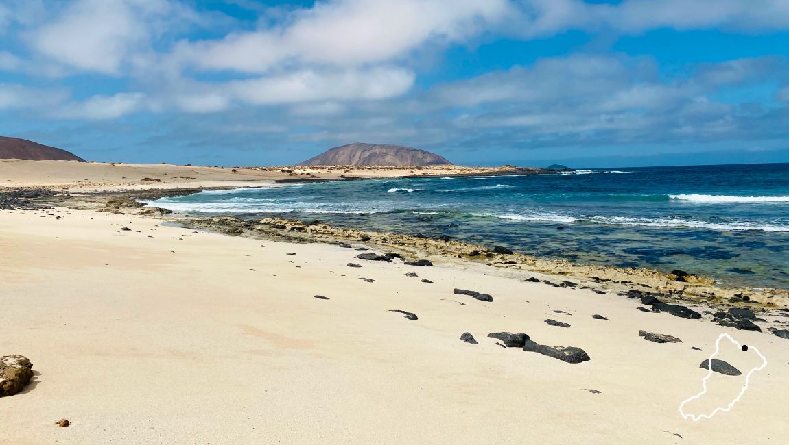
This is the same circular route that can be taken by bike and that runs along the north of the island. Two of the emblematic beaches of La Graciosa are visited; Las Conchas, Playa del Ambar, and also Pedro Barba, the other haven of the island’s population.
It is not a difficult route, perhaps the length of it if you do it all could be excessive if you arent used to walking, because it is a total of 15.4km.
The route has two ways, one a little shorter, finishing at Playa de Las Conchas and there you can enjoy the paradise-like landscape and the colour of its turquoise waters, since actually bathing there can be very dangerous due to the strong currents. Once on the beach it is recommended making the accent to Montana Bermeja, which will amaze you with its spectacular views of Montana Clara and all of La Graciosa from its summit of 157m in altitude.
The other way is to do the whole route and after visiting Playa de Las Conchas carry on to Playa del Ambar, approaching the basalt arches of Baja de Las Maspolomas and visiting the town of Pedro Barba, coming back via the path that passes through Las Agujas in the direction of La Mareta and from there on to Caleta de Sebo.
This hiking route in La Graciosa goes from Caleta de Sebo to Pedro Barba following a parallel line to the coast, and comes back via Punta de la Sonda and the edge of las Agujas. A total of 12.6km.
It is only possible to do this route on foot and certain sections are somewhat difficult due to the state of the route, especially between Barranco de los Conejos and Pedro Barba.
From Barranco de los Conejos, which lies between Caleta de Sebo and Pedro Barba, for 800m the terrain becomes more difficult and there are steep sections the make the route more difficult. After this stretch the rows of stones return that mark the route and it widens until you reach Pedro Barba.
Once in Pedro Barba take the street that runs next to the shore leaving the main route and take the path that forks to the right and leads to the sea and will take you to Punta de la Sonda along the coastline. On route of worthy note is the Budafero, a place where sea water shoots up with great force from a small hole, on days when there is a strong swell.
Continue the route and and we leave the coastline taking a path that comes from Playa del Ambar, heading back inland, via the Agujas, towards La Mareta, finally heading down to Caleta de Sebo.